For Preparing 3D Models overlapping photographs are important. Manually triggering Camera is very difficult and very time consuming. Further its may be fail to cover up overlap.
The Native DJI Flight Control software does not have any functionality to get overlapping photos.
Due to this Scenario we need to move third party software, Several Third party apps are available in play store and Apple store. However every apps have some short of pros and cons itself.
I have tested several Android apps for this purpose, within that I recommend Pix4d.
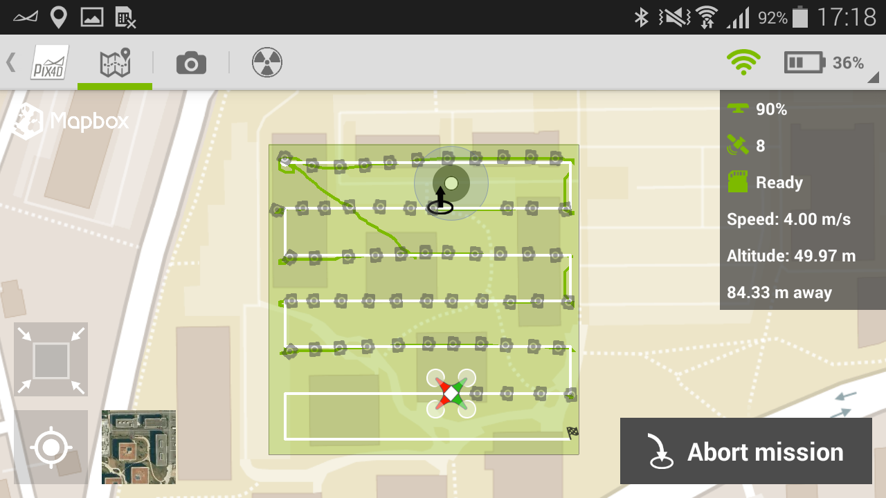 |
| Pix4D Android Interface |
Pros:
- The Pix4D is very simple and easy to work.
- Not necessary Laptop or Computers in Field
- Free App is available
- Live Feedback of Drone Position.
- Battery usage Guide.
Cons
- We are limited only in square shape. we can not input custom polygon shape.
- Camera Focusing only one side, for ContextCapture 3D Models need off nadir images. then you need to fly two times
For overcoming these cons, use UGCS (Universal Ground Control Software). The free version of this is can do anything but the limitation is 500 m radios limit of operation)
You can insert your Polygons, Digital Elevation Models etc. for your reference, Flight planning on Google maps, Google earth, Bing Maps etc, Then the flight planning become very easy.
Built in SRTM DEM facilitate you approximate elevation control of the Drone.
No any additional software are not necessary for operation.
CONS on UGCS - Computer is must in field.
MY STRONG RECOMMENDATION FOR FLIGHT PLANNING FOR 3D MODELLING USE UGCS. For Learn more
 |
| UGCS Flight Controlling Software interface |

